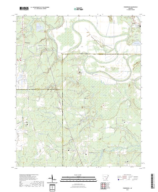
2024 Map of Pinebergen
USGS Topo · Published 2024About this map
Bayou Bartholomew winds through a landscape defined by the intersection of Jefferson, Lincoln, and Cleveland counties, anchoring a region of bottomlands and small settlements. The community of Pinebergen sits in the northwest, while the hamlet of Hooker and the landmark Mount Lebanon Cem occupy the northeast corner. This modern survey reveals a dense concentration of small family and community burial grounds, including Old Macedonia Cem, Huckaby Cem, and New Owen Cem, which serve as vital markers for local genealogists. The terrain is marked by intricate water systems such as Bradshaw Brake and Fish Lake, reflecting the hydrological character of the Arkansas Delta. Rural connectivity is maintained through an extensive network of county roads like Old Star City Rd and Alexander Rd, which bridge the gap between the isolated homesteads and the larger bayou system.
Find a feature on this map
67 named features on this map. Tap any name to fly to it.
Don’t see what you’re looking for? This feature index may not catch every label — zoom into the map to look around manually.
Map Details
Editions of this 2024 Pinebergen Map
This is the sole edition of this map. No revisions or reprints were ever made.
Other maps of this area

1935 · Feenyville
USGS Topo · 1:62,500

1935 · Noble Lake
USGS Topo · 1:62,500

1948 · Helena
USGS Topo · 1:250,000

1950 · Helena
USGS Topo · 1:250,000

1953 · Greenwood
USGS Topo · 1:250,000

1953 · El Dorado
USGS Topo · 1:250,000

1955 · Helena
USGS Topo · 1:250,000

1955 · Little Rock
USGS Topo · 1:250,000

1956 · Little Rock
USGS Topo · 1:250,000

1956 · Greenwood
USGS Topo · 1:250,000