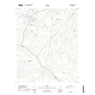
2019 Map of Pinebluff
USGS Topo · Published 2019About this map
Pinebluff and Aberdeen anchor this 2019 survey, showing the established grid of the Sandhills region at the intersection of Moore, Richmond, Scotland, and Hoke counties. The landscape is a network of small settlements and residential pockets such as Lincoln Park, Silver Springs, and Ashley Heights, alongside significant military-managed lands. To the east, the map captures a portion of Fort Bragg, while the Mackall Army Airfield sits in the southwestern quadrant, illustrating the long-standing defense footprint in the area.
Find a feature on this map
133 named features on this map. Tap any name to fly to it.
Don’t see what you’re looking for? This feature index may not catch every label — zoom into the map to look around manually.
Map Details
Editions of this 2019 Pinebluff Map
This is the sole edition of this map. No revisions or reprints were ever made.
Other maps of this area

1942 · Troy
USGS Topo · 1:125,000

1942 · Rockingham
USGS Topo · 1:125,000

1948 · Southern Pines
USGS Topo · 1:62,500

1948 · Pinebluff
USGS Topo · 1:24,000

1948 · Mc Cain
USGS Topo · 1:24,000

1949 · Wagram
USGS Topo · 1:24,000

1949 · Silver Hill
USGS Topo · 1:24,000

1949 · West End
USGS Topo · 1:24,000

1949 · Hoffman
USGS Topo · 1:24,000

1949 · Marston
USGS Topo · 1:24,000