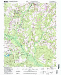
2002 Map of Pinebluff
USGS Topo · Published 2002About this map
Pinebluff and its neighboring communities are captured in this landscape defined by the intersection of military, rail, and rural life in the early 21st century. The map highlights the transition from the town center of Pinebluff to the expansive Camp Mackall Military Reservation and portions of the Fort Bragg Military Reservation. A notable industrial artifact is the Ice Loading Platform located near Aberdeen, hinting at the region's agricultural shipping history.
Find a feature on this map
32 named features on this map. Tap any name to fly to it.
Don’t see what you’re looking for? This feature index may not catch every label — zoom into the map to look around manually.
Map Details
Editions of this 2002 Pinebluff Map
This is the sole edition of this map. No revisions or reprints were ever made.
Other maps of this area

1942 · Troy
USGS Topo · 1:125,000

1942 · Rockingham
USGS Topo · 1:125,000

1948 · Southern Pines
USGS Topo · 1:62,500

1948 · Pinebluff
USGS Topo · 1:24,000

1948 · Mc Cain
USGS Topo · 1:24,000

1949 · Wagram
USGS Topo · 1:24,000

1949 · Silver Hill
USGS Topo · 1:24,000

1949 · West End
USGS Topo · 1:24,000

1949 · Hoffman
USGS Topo · 1:24,000

1949 · Marston
USGS Topo · 1:24,000