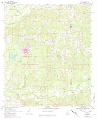
1969 Map of Pinebur
USGS Topo · Published 1982About this map
The Marion County State Wildlife Management Area anchors the landscape of southern Mississippi, dominated by a dense network of watercourses including Upper Big Creek and the Boggy Prong. This 1960s environment, updated with 1980s data, shows the transition of the timber and transport economy through the presence of an Old Railroad Grade running near the settlement of Pinebur. Community life is rooted in the landscape at Brushy Creek Ch and Pinebur Ch, while recreational and resource management is evident in the development of Lake Bill Waller, Lake Columbia, and Lake Watts. The eastern boundary is defined by the Marion Co and Lamar Co line, crossing through rugged terrain where Hollywood Spring and various gravel pits suggest the local geological utility.
Find a feature on this map
35 named features on this map. Tap any name to fly to it.
Don’t see what you’re looking for? This feature index may not catch every label — zoom into the map to look around manually.
Map Details
Editions of this 1969 Pinebur Map
2 editions found
Other maps of this area

1953 · Hattiesburg
USGS Topo · 1:250,000

1958 · Hattiesburg
USGS Topo · 1:250,000

1969 · Baxterville SW
USGS Topo · 1:24,000
1969 · Baxterville
USGS Topo · 1:24,000

1969 · Baxterville NE
USGS Topo · 1:24,000

1969 · Pinebur
USGS Topo · 1:24,000

1970 · Columbia South
USGS Topo · 1:24,000

1970 · Columbia North
USGS Topo · 1:24,000
1970 · Sandy Hook
USGS Topo · 1:24,000

1974 · Oloh
USGS Topo · 1:24,000