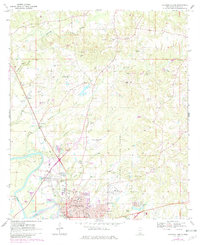
1970 Map of Columbia North
USGS Topo · Published 1982About this map
The Pearl River snakes along the southwestern edge of this landscape, defining the character of the Marion County terrain as it transitions from the river bottoms to the rolling uplands. The city of Columbia serves as the focal point, showing a detailed urban grid featuring the Courthouse, City Hall, and the Armory. An extensive transportation and industrial network supports the area, highlighted by the Illinois Central Gulf railroad and numerous Gravel Pit operations scattered throughout the countryside.
Find a feature on this map
44 named features on this map. Tap any name to fly to it.
Don’t see what you’re looking for? This feature index may not catch every label — zoom into the map to look around manually.
Map Details
Editions of this 1970 Columbia North Map
3 editions found
Other maps of this area

1953 · Hattiesburg
USGS Topo · 1:250,000

1958 · Hattiesburg
USGS Topo · 1:250,000

1969 · Pinebur
USGS Topo · 1:24,000

1970 · Columbia South
USGS Topo · 1:24,000

1970 · Sandy Hook NW
USGS Topo · 1:24,000

1970 · Bunker Hill
USGS Topo · 1:24,000

1970 · Morgantown
USGS Topo · 1:24,000

1970 · Oak Vale
USGS Topo · 1:24,000

1970 · Columbia North
USGS Topo · 1:24,000

1974 · Bassfield
USGS Topo · 1:24,000