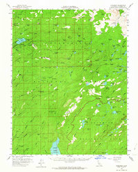
1956 Map of Pinecrest
USGS Topo · Published 1964About this map
Pinecrest and the surrounding wilderness of the Stanislaus National Forest are captured here during a period of active mountain recreation and timber history. The presence of RR Logging grades and the Pinecrest Lookout highlights the dual legacy of resource extraction and fire management in the high Sierra. Settlements and seasonal outposts like Bumblebee, Fiddlers Green, and Gianelli Cabin are interspersed among the drainages of the South Fork Stanislaus River and the Clavey River. This 1950s survey also details the early infrastructure of the Camp Mac Bride (BSA) scout camp on the shores of Pinecrest Lake, while the southeastern corner reaches into the pristine northern boundary of Yosemite National Park near Kibbie Ridge.
Find a feature on this map
134 named features on this map. Tap any name to fly to it.
Don’t see what you’re looking for? This feature index may not catch every label — zoom into the map to look around manually.
Map Details
Editions of this 1956 Pinecrest Map
4 editions found

Other maps of this area

1891 · Big Trees
USGS Topo · 1:125,000

1893 · Sonora
USGS Topo · 1:125,000

1894 · Big Trees
USGS Topo · 1:125,000

1896 · Dardanelles
USGS Topo · 1:125,000

1896 · Sonora
USGS Topo · 1:125,000

1897 · Sonora
USGS Topo · 1:125,000

1897 · Big Trees
USGS Topo · 1:125,000

1897 · Yosemite
USGS Topo · 1:125,000

1898 · Dardanelles
USGS Topo · 1:125,000

1898 · Sonora
USGS Topo · 1:125,000