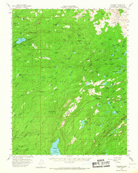
1956 Map of Pinecrest
USGS Topo · Published 1968About this map
Pinecrest and the surrounding high Sierra landscape define this mid-century survey of the Stanislaus National Forest. Centered on the recreation and timber lands of Tuolumne County, the map captures a network of seasonal camps and specialized landmarks such as Camp Mac Bride (BSA), Crabtree Camp, and the Pinecrest Lookout near the shores of Pinecrest Lake. The terrain is characterized by a high concentration of named meadows and peaks, including the evocative Fiddlers Green, Horse and Cow Meadow, and Burst Rock.
Find a feature on this map
127 named features on this map. Tap any name to fly to it.
Don’t see what you’re looking for? This feature index may not catch every label — zoom into the map to look around manually.
Map Details
Editions of this 1956 Pinecrest Map
4 editions found

Other maps of this area

1891 · Big Trees
USGS Topo · 1:125,000

1893 · Sonora
USGS Topo · 1:125,000

1894 · Big Trees
USGS Topo · 1:125,000

1896 · Dardanelles
USGS Topo · 1:125,000

1896 · Sonora
USGS Topo · 1:125,000

1897 · Sonora
USGS Topo · 1:125,000

1897 · Big Trees
USGS Topo · 1:125,000

1897 · Yosemite
USGS Topo · 1:125,000

1898 · Dardanelles
USGS Topo · 1:125,000

1898 · Sonora
USGS Topo · 1:125,000