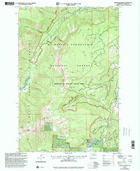
2000 Map of Pinegrass Ridge
USGS Topo · Published 2001About this map
Pinegrass Ridge dominates the high-elevation terrain of this central Washington survey, marking a significant boundary between the Mt Baker - Snoqualmie National Forest and territory managed by the Wenatchee National Forest. This landscape is defined by its water systems and protected lands, where the Pacific Crest Nat Scenic Trail winds through the Goat Rocks Wilderness near prominent landmarks like Bear Creek Mtn and Devils Horn. The drainage patterns are clearly visible as the North Fork Tieton River and South Fork Tieton River converge, feeding into Clear Lake and the Tieton River. Lower-lying alpine areas like Tieton Meadows and Conrad Meadows provide contrast to the surrounding ridges, while remote water bodies such as Phantom Lake and Hell Lake dot the wilderness interior.
Find a feature on this map
42 named features on this map. Tap any name to fly to it.
Don’t see what you’re looking for? This feature index may not catch every label — zoom into the map to look around manually.
Map Details
Editions of this 2000 Pinegrass Ridge Map
This is the sole edition of this map. No revisions or reprints were ever made.
Other maps of this area

1902 · Mount Aix
USGS Topo · 1:125,000

1904 · Mt Aix
USGS Topo · 1:125,000

1904 · Mount Adams
USGS Topo · 1:125,000

1907 · Mount Adams
USGS Topo · 1:125,000

1950 · Yakima
USGS Topo · 1:250,000

1958 · Yakima
USGS Topo · 1:250,000

1961 · Yakima
USGS Topo · 1:250,000

1962 · White Pass
USGS Topo · 1:62,500

1967 · Rimrock Lake
USGS Topo · 1:24,000

1967 · Darland Mtn
USGS Topo · 1:24,000