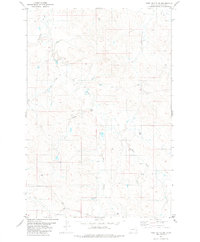
1981 Map of Piney Butte SW
USGS Topo · Published 1981About this map
Miles City Cutoff traverses this corner of Carter County, Montana, cutting across a landscape defined by an intricate network of seasonal drainage and prairie waterways. The survey captures the ranching character of the region during the 1970s, documented through a series of significant creek systems including O Fallon Creek, Lone Tree Creek, and Hanley Creek. The terrain is marked by numerous water sources critical to local land use, from the East Fork Spring Creek to scattered features like a Flowing Well. These labels provide specific geographic anchors for researchers tracing historical land boundaries or the early paths of regional travel across the Montana plains. The presence of several Well and spring markers highlights the importance of water management in this arid environment, while elevation markers like BM 3246 and BM 3213 provide precise data points for the rolling topography.
Find a feature on this map
16 named features on this map. Tap any name to fly to it.
Don’t see what you’re looking for? This feature index may not catch every label — zoom into the map to look around manually.
Map Details
Editions of this 1981 Piney Butte SW Map
This is the sole edition of this map. No revisions or reprints were ever made.
Other maps of this area

1953 · Miles City
USGS Topo · 1:250,000

1954 · Ekalaka
USGS Topo · 1:250,000

1956 · Ekalaka
USGS Topo · 1:250,000

1957 · Miles City
USGS Topo · 1:250,000

1958 · Miles City
USGS Topo · 1:250,000

1958 · Ekalaka
USGS Topo · 1:250,000

1965 · Ekalaka
USGS Topo · 1:250,000

1979 · Board Corral Creek
USGS Topo · 1:24,000

1979 · Ekalaka
USGS Topo · 1:24,000

1979 · Beaver Flats North
USGS Topo · 1:24,000