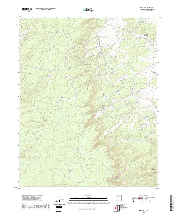
2021 Map of Piney Hill
USGS Topo · Published 2021About this map
The high high desert of the Defiance Plateau defines this landscape in eastern Arizona, characterized by an intricate network of seasonal drainage and perennial water sources. Rising above the plateau, Piney Hill overlooks the headwaters of Kinlichee Cr and the expansive Piney Hill Wash. The map reveals a land structured by ancient paths and remote ranch roads, including Summit Rd and Blue Canyon Rd. Valuable water points such as Bephibito Spring, Bonito Spring, and Cold Spring appear as vital nodes in the terrain, while the broader Talhchoze Tohe Meadow suggests a rare pocket of flatter grazing or gathering land amidst the winding washes. The presence of numerous named drainages, like Scattered Willow Wash and Black Soil Wash, highlights the seasonal movement of water across this high-elevation reach of the Navajo Nation.
Find a feature on this map
32 named features on this map. Tap any name to fly to it.
Don’t see what you’re looking for? This feature index may not catch every label — zoom into the map to look around manually.
Map Details
Editions of this 2021 Piney Hill Map
This is the sole edition of this map. No revisions or reprints were ever made.
Other maps of this area

1886 · Fort Defiance
USGS Topo · 1:250,000

1892 · Fort Defiance
USGS Topo · 1:250,000

1954 · Gallup
USGS Topo · 1:250,000

1955 · Zith-Tusayan Butte 2 SE
USGS Topo · 1:24,000

1955 · Zith-Tusayan Butte 4 NW
USGS Topo · 1:24,000

1955 · Zith-Tusayan Butte 3 NE
USGS Topo · 1:24,000

1955 · Zith-Tusayan Butte 4 NE
USGS Topo · 1:24,000

1955 · Zith-Tusayan Butte 2 NE
USGS Topo · 1:24,000

1955 · Zith-Tusayan Butte 1 SE
USGS Topo · 1:24,000
1955 · Zith-Tusayan Butte 1 NE
USGS Topo · 1:24,000