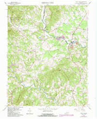
1963 Map of Piney River
USGS Topo · Published 1984About this map
Turkey Mtn and Horsley Mountain dominate the central terrain of this Virginia Piedmont landscape, where the Buffalo River and Piney River converge near the border of Amherst and Nelson Counties. The map reveals an industrial and rural economy defined by the Virginia Blue Ridge Railway, which served the local quarries and mines during the early 1960s. Extensive mining operations, including multiple instances of quarries, mine dumps, and a Tailings Pond, cluster around the Piney River settlement, reflecting the area's geological importance.
Find a feature on this map
72 named features on this map. Tap any name to fly to it.
Don’t see what you’re looking for? This feature index may not catch every label — zoom into the map to look around manually.
Map Details
Editions of this 1963 Piney River Map
2 editions found
Other maps of this area

1892 · Buckingham
USGS Topo · 1:125,000

1894 · Lexington
USGS Topo · 1:125,000

1935 · Amherst
USGS Topo · 1:48,000

1936 · Vesuvius
USGS Topo · 1:48,000

1939 · Amherst
USGS Topo · 1:62,500

1941 · Vesuvius
USGS Topo · 1:62,500

1943 · Lovingston
USGS Topo · 1:62,500

1946 · Lovingston
USGS Topo · 1:62,500

1947 · Roanoke
USGS Topo · 1:250,000

1950 · Amherst
USGS Topo · 1:62,500