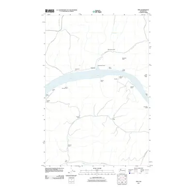
2011 Map of Ping
USGS Topo · Published 2011About this map
Ping and Penawawa sit within the high-relief canyon country of southeastern Washington, where the Snake River carves through the basaltic landscape. By the early 21st century, the river had been transformed into Lake Bryan, though the original gravel bars and river features remain identified by name, including Penawawa Bar, Rice Bar, and Swift Bar. The settlement pattern follows the steep topography, with roads like Ping Gulch Rd and Penawawa Rd navigating the deep incisions of Penawawa Canyon and Ping Gulch.
Find a feature on this map
35 named features on this map. Tap any name to fly to it.
Don’t see what you’re looking for? This feature index may not catch every label — zoom into the map to look around manually.
Map Details
Editions of this 2011 Ping Map
This is the sole edition of this map. No revisions or reprints were ever made.
Other maps of this area

1950 · La Crosse
USGS Topo · 1:62,500

1950 · Penawawa
USGS Topo · 1:62,500

1950 · Endicott
USGS Topo · 1:62,500

1950 · Hay
USGS Topo · 1:62,500

1952 · Hay
USGS Topo · 1:62,500

1952 · La Crosse
USGS Topo · 1:62,500

1955 · Pullman
USGS Topo · 1:250,000

1958 · Pullman
USGS Topo · 1:250,000

1981 · Dusty
USGS Topo · 1:24,000
1981 · Central Ferry
USGS Topo · 1:24,000