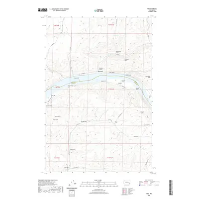
2020 Map of Ping
USGS Topo · Published 2020About this map
Snake River frontage and the steep drainages of the Palouse region define this landscape at the boundary of Whitman and Garfield counties. The settlement of Penawawa sits on the northern bank, positioned near historic river features like Penawawa Bar and the mouth of Penawawa Cr. The map illustrates the difficult transit between the river valley and the high plateau, evidenced by steep routes such as Fincher Grade and Bratcher Grade Rd.
Find a feature on this map
46 named features on this map. Tap any name to fly to it.
Don’t see what you’re looking for? This feature index may not catch every label — zoom into the map to look around manually.
Map Details
Editions of this 2020 Ping Map
This is the sole edition of this map. No revisions or reprints were ever made.
Other maps of this area

1950 · La Crosse
USGS Topo · 1:62,500

1950 · Penawawa
USGS Topo · 1:62,500

1950 · Endicott
USGS Topo · 1:62,500

1950 · Hay
USGS Topo · 1:62,500

1952 · Hay
USGS Topo · 1:62,500

1952 · La Crosse
USGS Topo · 1:62,500

1955 · Pullman
USGS Topo · 1:250,000

1958 · Pullman
USGS Topo · 1:250,000

1981 · Dusty
USGS Topo · 1:24,000
1981 · Central Ferry
USGS Topo · 1:24,000