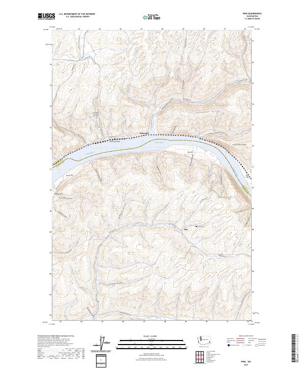
2023 Map of Ping
USGS Topo · Published 2023About this map
The Snake River carves a deep path through this landscape, separating Whitman and Garfield counties. The river's historical importance is evident in the numerous named sandbars and crossings, such as Penawawa Bar, Rice Bar, and Swift Bar. High above the water, the terrain is defined by dramatic elevations like Penawawa Ridge and Long Hollow Ridge, which are dissected by a network of steep drainages including Lewellen Gulch and Schaefer Gulch.
Find a feature on this map
48 named features on this map. Tap any name to fly to it.
Don’t see what you’re looking for? This feature index may not catch every label — zoom into the map to look around manually.
Map Details
Editions of this 2023 Ping Map
This is the sole edition of this map. No revisions or reprints were ever made.
Other maps of this area

1950 · La Crosse
USGS Topo · 1:62,500

1950 · Penawawa
USGS Topo · 1:62,500

1950 · Endicott
USGS Topo · 1:62,500

1950 · Hay
USGS Topo · 1:62,500

1952 · Hay
USGS Topo · 1:62,500

1952 · La Crosse
USGS Topo · 1:62,500

1955 · Pullman
USGS Topo · 1:250,000

1958 · Pullman
USGS Topo · 1:250,000

1981 · Dusty
USGS Topo · 1:24,000
1981 · Central Ferry
USGS Topo · 1:24,000