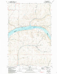
1981 Map of Ping
USGS Topo · Published 1981About this map
Ping sits in the southeastern corner of this study, tucked into the hills above the Ping Gulch drainage. This landscape is defined by the massive carving of the Lake Bryan Snake River, which forms the boundary between Whitman and Garfield Counties. Along the river’s edge, flat gravel deposits like Rice Bar, Tucker Bar, and Swift Bar provide rare level ground beneath steep canyon walls.
Find a feature on this map
36 named features on this map. Tap any name to fly to it.
Don’t see what you’re looking for? This feature index may not catch every label — zoom into the map to look around manually.
Map Details
Editions of this 1981 Ping Map
This is the sole edition of this map. No revisions or reprints were ever made.
Other maps of this area

1950 · La Crosse
USGS Topo · 1:62,500

1950 · Penawawa
USGS Topo · 1:62,500

1950 · Endicott
USGS Topo · 1:62,500

1950 · Hay
USGS Topo · 1:62,500

1952 · Hay
USGS Topo · 1:62,500

1952 · La Crosse
USGS Topo · 1:62,500

1955 · Pullman
USGS Topo · 1:250,000

1958 · Pullman
USGS Topo · 1:250,000

1981 · Dusty
USGS Topo · 1:24,000
1981 · Central Ferry
USGS Topo · 1:24,000