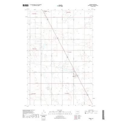
2017 Map of Pingree
USGS Topo · Published 2017About this map
Pingree and Edmunds stand as primary settlements in this central North Dakota landscape, situated along the diagonal corridor of U.S. Route 281. The map illustrates a classic Great Plains section-line road grid, where avenues like 71st Ave SE and 76th Ave SE frame a territory dominated by small prairie potholes and meandering waterways. Pipestem Creek winds through the western half of the quadrangle, feeding into a complex network of wetlands and small basins such as Dollar Lake. For those tracing local history or genealogy, the town of Pingree is detailed with residential streets including Lincoln Ave and English Ave, while the nearby Rest Cem provides a significant point of interest for researchers of the area's early residents and family legacies.
Find a feature on this map
29 named features on this map. Tap any name to fly to it.
Don’t see what you’re looking for? This feature index may not catch every label — zoom into the map to look around manually.
Map Details
Editions of this 2017 Pingree Map
This is the sole edition of this map. No revisions or reprints were ever made.
Other maps of this area

1900 · Pingree
USGS Topo · 1:125,000

1900 · Pingree
USGS Topo · 1:62,500

1948 · Carrington
USGS Topo · 1:62,500

1950 · Melville
USGS Topo · 1:24,000

1950 · Buchanan
USGS Topo · 1:24,000

1951 · Arrowwood Lake
USGS Topo · 1:24,000

1951 · Pingree
USGS Topo · 1:24,000

1951 · Bordulac SW
USGS Topo · 1:24,000

1952 · Buchanan
USGS Topo · 1:24,000

1952 · Jim Lake
USGS Topo · 1:24,000