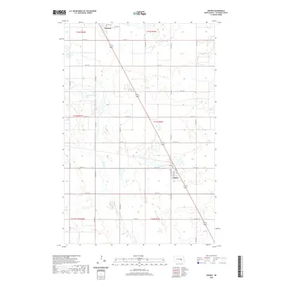
2020 Map of Pingree
USGS Topo · Published 2020About this map
Pingree serves as the primary hub in this central North Dakota landscape, situated along a prominent transportation corridor that bisects the terrain. The community is defined by its grid of streets, including Lincoln Ave, Bentley Ave, and English Ave, while the surrounding prairie is dotted with glacial wetlands and intermittent waterways. To the north, the small settlement of Edmunds marks a quiet corner of the plains near the Melville Cem. The meandering path of Pipestem Creek flows through the western portion of the quadrangle, carving a subtle valley through the agricultural sections. For local historians and genealogists, the inclusion of Rest Cem and various section-line roads like 73rd Ave SE and 17th St SE provides a clear framework for tracing family landholdings and the placement of historic farmsteads within the township and range system.
Find a feature on this map
30 named features on this map. Tap any name to fly to it.
Don’t see what you’re looking for? This feature index may not catch every label — zoom into the map to look around manually.
Map Details
Editions of this 2020 Pingree Map
This is the sole edition of this map. No revisions or reprints were ever made.
Other maps of this area

1900 · Pingree
USGS Topo · 1:125,000

1900 · Pingree
USGS Topo · 1:62,500

1948 · Carrington
USGS Topo · 1:62,500

1950 · Melville
USGS Topo · 1:24,000

1950 · Buchanan
USGS Topo · 1:24,000

1951 · Arrowwood Lake
USGS Topo · 1:24,000

1951 · Pingree
USGS Topo · 1:24,000

1951 · Bordulac SW
USGS Topo · 1:24,000

1952 · Buchanan
USGS Topo · 1:24,000

1952 · Jim Lake
USGS Topo · 1:24,000