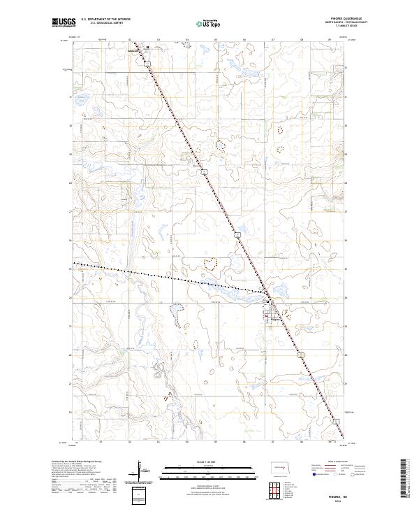
2024 Map of Pingree
USGS Topo · Published 2024About this map
Pingree and the small settlement of Edmunds anchor this map of Stutsman County, highlighting a landscape defined by the North Dakota prairie and the slow-moving course of Pipestem Creek. The creek meanders through a valley of wetlands and small kettle lakes, including Dollar Lake, which characterize the region's glacial topography. This area is critically important for migratory birds, as evidenced by the large Stutsman County Waterfowl Production Area that spans several sections. US Highway 281 cuts a straight line southeast through the territory, connecting the rural grid of section-line roads like 75th Ave SE and 17th St SE. Local history is preserved at the Rest Cem near the town site and Melville Cem to the north, offering fixed points of interest for genealogists tracing early families in these farming townships.
Find a feature on this map
30 named features on this map. Tap any name to fly to it.
Don’t see what you’re looking for? This feature index may not catch every label — zoom into the map to look around manually.
Map Details
Editions of this 2024 Pingree Map
This is the sole edition of this map. No revisions or reprints were ever made.
Other maps of this area

1900 · Pingree
USGS Topo · 1:125,000

1900 · Pingree
USGS Topo · 1:62,500

1948 · Carrington
USGS Topo · 1:62,500

1950 · Melville
USGS Topo · 1:24,000

1950 · Buchanan
USGS Topo · 1:24,000

1951 · Arrowwood Lake
USGS Topo · 1:24,000

1951 · Pingree
USGS Topo · 1:24,000

1951 · Bordulac SW
USGS Topo · 1:24,000

1952 · Buchanan
USGS Topo · 1:24,000

1952 · Jim Lake
USGS Topo · 1:24,000