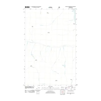
2011 Map of Pinnacle Mountain
USGS Topo · Published 2011About this map
Lake Chelan anchors the northeastern corner of this high-elevation landscape in the Cascades, where the water's edge meets the steep slopes of Flora Mountain. The map detail captures a rugged watershed defined by the Entiat River and its headwaters at Entiat Meadows, surrounded by prominent summits including Pinnacle Mountain and Lucerne Mountain. This 2011 survey reveals a complex drainage system where numerous creeks like Railroad Creek, Klone Creek, and Tumble Creek carve through the terrain toward the lower basins. Recreation and wilderness navigation are centered around landmarks such as Elephant Rock Campground near the lake, while backcountry points of interest like Mirror Lake, Dole Lakes, and Emerald Park provide clear reference points for those tracing historical trails and mountain geography.
Find a feature on this map
27 named features on this map. Tap any name to fly to it.
Don’t see what you’re looking for? This feature index may not catch every label — zoom into the map to look around manually.
Map Details
Editions of this 2011 Pinnacle Mountain Map
This is the sole edition of this map. No revisions or reprints were ever made.
Other maps of this area

1902 · Stehekin
USGS Topo · 1:125,000

1904 · Stehekin
USGS Topo · 1:125,000

1944 · Holden
USGS Topo · 1:62,500

1944 · Lucerne
USGS Topo · 1:62,500

1949 · Lucerne
USGS Topo · 1:62,500

1949 · Holden
USGS Topo · 1:62,500

1955 · Concrete
USGS Topo · 1:250,000

1958 · Concrete
USGS Topo · 1:250,000

1962 · Concrete
USGS Topo · 1:250,000
1963 · Mt Lyall
USGS Topo · 1:24,000