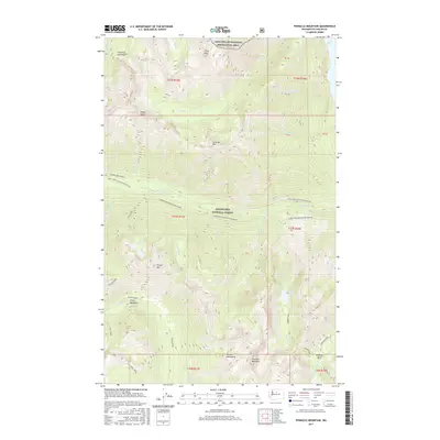
2017 Map of Pinnacle Mountain
USGS Topo · Published 2017About this map
Pinnacle Mountain rises as a central peak in this high-elevation landscape within the Wenatchee National Forest, where the terrain is defined by deep glacial valleys and sharp ridges. The northern reaches are governed by the Lake Chelan National Recreation Area, bordered by the expansive waters of Lake Chelan. This 2017 survey details a network of drainage systems including Railroad Cr and the Entiat River, which originates near the Entiat Meadows. The map illustrates the protected status of the high country through the Lower Railroad Cr Wilderness and features remote landmarks such as Monkey Bear Falls and the high-altitude Dole Lakes. These features represent the headwaters and crests of the Chelan Mountains, providing a technical view of the alpine geography before modern climate shifts further impact these perennial water sources.
Find a feature on this map
47 named features on this map. Tap any name to fly to it.
Don’t see what you’re looking for? This feature index may not catch every label — zoom into the map to look around manually.
Map Details
Editions of this 2017 Pinnacle Mountain Map
This is the sole edition of this map. No revisions or reprints were ever made.
Other maps of this area

1902 · Stehekin
USGS Topo · 1:125,000

1904 · Stehekin
USGS Topo · 1:125,000

1944 · Holden
USGS Topo · 1:62,500

1944 · Lucerne
USGS Topo · 1:62,500

1949 · Lucerne
USGS Topo · 1:62,500

1949 · Holden
USGS Topo · 1:62,500

1955 · Concrete
USGS Topo · 1:250,000

1958 · Concrete
USGS Topo · 1:250,000

1962 · Concrete
USGS Topo · 1:250,000
1963 · Mt Lyall
USGS Topo · 1:24,000