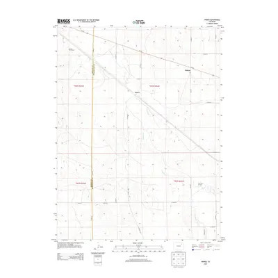
2013 Map of Pinneo
USGS Topo · Published 2013About this map
Pinneo and the adjacent community of Midway sit at the intersection of a vast agricultural grid and early industrial infrastructure on the high plains. This landscape is defined by its rectilinear organization, where a network of county roads like Co Road N and Co Road S divide the terrain into large parcels of ranching and farmland. The seasonal drainage of Camp Creek provides a rare natural break in the geometric surveying of the region. Local economic history is evident in the presence of the West Xenia Oil Field, which marks the extractive industry that has long supported the area alongside traditional agriculture. Evidence of earlier ranching techniques persists in features like the Old Black Tank Windmill, a critical piece of water-management history in this arid environment. The map also traces the jurisdictional line of Morgan Co Washington Co, showing how local boundaries bisect the rural landscape.
Find a feature on this map
26 named features on this map. Tap any name to fly to it.
Don’t see what you’re looking for? This feature index may not catch every label — zoom into the map to look around manually.
Map Details
Editions of this 2013 Pinneo Map
This is the sole edition of this map. No revisions or reprints were ever made.
Other maps of this area

1951 · Merino SW
USGS Topo · 1:24,000

1951 · Brush East
USGS Topo · 1:24,000

1951 · Merino SE
USGS Topo · 1:24,000

1954 · Sterling
USGS Topo · 1:250,000

1958 · Sterling
USGS Topo · 1:250,000

1965 · Gary
USGS Topo · 1:24,000

1965 · Miller Ranch
USGS Topo · 1:24,000

1971 · Brush East
USGS Topo · 1:24,000

1973 · Rago
USGS Topo · 1:24,000

1973 · Fremont Butte
USGS Topo · 1:24,000