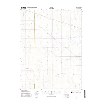
2016 Map of Pinneo
USGS Topo · Published 2016About this map
Pinneo and the surrounding high plains of Eastern Colorado are defined by a rhythmic grid of section lines and gravel roads at the headwaters of Camp Cr. This 2016 survey shows the sparse ranching landscape where the Morgan County and Washington County line divides the terrain. The map documents the localized concentration of water resources and wetlands along the drainage of Camp Cr, contrasting with the surrounding dry land. Aside from the small cluster at Pinneo, the settlement at Midway represents the primary point of human activity along the northern corridor. The systematic layout of county routes, including Co RD 46, Co RD 40, and Co RD Q, reveals the enduring structure of the Public Land Survey System as it organizes the rural economy in the modern era.
Find a feature on this map
19 named features on this map. Tap any name to fly to it.
Don’t see what you’re looking for? This feature index may not catch every label — zoom into the map to look around manually.
Map Details
Editions of this 2016 Pinneo Map
This is the sole edition of this map. No revisions or reprints were ever made.
Other maps of this area

1951 · Merino SW
USGS Topo · 1:24,000

1951 · Brush East
USGS Topo · 1:24,000

1951 · Merino SE
USGS Topo · 1:24,000

1954 · Sterling
USGS Topo · 1:250,000

1958 · Sterling
USGS Topo · 1:250,000

1965 · Gary
USGS Topo · 1:24,000

1965 · Miller Ranch
USGS Topo · 1:24,000

1971 · Brush East
USGS Topo · 1:24,000

1973 · Rago
USGS Topo · 1:24,000

1973 · Fremont Butte
USGS Topo · 1:24,000