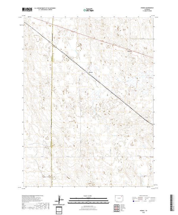
2022 Map of Pinneo
USGS Topo · Published 2022About this map
The boundary between Morgan Co and Washington Co bisects this high-plains landscape, where the settlement of Pinneo sits at a junction of roads and historical land divisions. This 2022 survey documents an arid environment defined by the ephemeral path of Camp Creek, which meanders across the eastern half of the quadrangle. The township-and-range system, visible in the grids of t3n r54w, t3n r55w, t2n r54w, and t2n r55w, dictates the placement of the rural road network, including Co Rd Q and Co Rd 40. To the northeast, the small cluster at Midway remains a notable reference point in an area characterized by scattered wetlands and low-relief terrain. The map provides a precise account of modern county line demarcations and the infrastructure supporting this remote section of Eastern Colorado.
Find a feature on this map
20 named features on this map. Tap any name to fly to it.
Don’t see what you’re looking for? This feature index may not catch every label — zoom into the map to look around manually.
Map Details
Editions of this 2022 Pinneo Map
This is the sole edition of this map. No revisions or reprints were ever made.
Other maps of this area

1951 · Merino SW
USGS Topo · 1:24,000

1951 · Brush East
USGS Topo · 1:24,000

1951 · Merino SE
USGS Topo · 1:24,000

1954 · Sterling
USGS Topo · 1:250,000

1958 · Sterling
USGS Topo · 1:250,000

1965 · Gary
USGS Topo · 1:24,000

1965 · Miller Ranch
USGS Topo · 1:24,000

1971 · Brush East
USGS Topo · 1:24,000

1973 · Rago
USGS Topo · 1:24,000

1973 · Fremont Butte
USGS Topo · 1:24,000