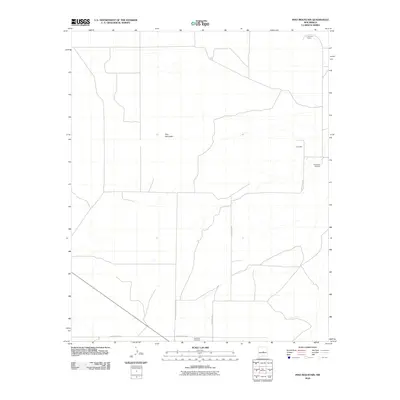
2010 Map of Pino Mountain
USGS Topo · Published 2010About this map
Pino Mountain rises as a prominent landmark in this high-desert landscape of Torrance County, where the infrastructure of early ranching and rural life remains visible. The local history of the area is anchored by the Pinos Wells Cemetery and the nearby Piños Well, reflecting a reliance on isolated water sources and long-standing family ties to the land. Further south, the Cedarvale Cemetery marks the periphery of a neighboring settlement, connected by a network of rural thoroughfares including Pinos Wells Rd and County Rd-C010. The presence of the Lammon Ranch in the northern reaches further illustrates the continued agricultural use of this arid terrain, where vast tracts of land are defined more by elevation and essential wells than by dense development.
Find a feature on this map
7 named features on this map. Tap any name to fly to it.
Don’t see what you’re looking for? This feature index may not catch every label — zoom into the map to look around manually.
Map Details
Editions of this 2010 Pino Mountain Map
This is the sole edition of this map. No revisions or reprints were ever made.
Other maps of this area

1954 · Fort Sumner
USGS Topo · 1:250,000

1958 · Fort Sumner
USGS Topo · 1:250,000

1978 · Negra SW
USGS Topo · 1:24,000

1978 · Negra SE
USGS Topo · 1:24,000

1978 · Rattlesnake Hill
USGS Topo · 1:24,000

1980 · Corona
USGS Topo · 1:100,000

1981 · Progresso NE
USGS Topo · 1:24,000

1981 · Pino Mountain
USGS Topo · 1:24,000
1981 · Progresso SE
USGS Topo · 1:24,000
1981 · Cedarvale NE
USGS Topo · 1:24,000