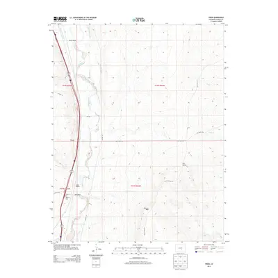
2013 Map of Pinon
USGS Topo · Published 2013About this map
Fountain Creek serves as the central artery for this arid landscape, flanked by a complex network of irrigation infrastructure designed to divert water across the plains. These engineered waterways, including the Jackson and Burke Ditch and the Greenville Ditch, reflect the agricultural necessity of managing scarce resources in this part of Pueblo County. The small settlements of Piñon and Bragdon are positioned along the transit corridors that parallel the creek, while the topography rises toward the east at Baculite Mesa. Water management is further evidenced by the Greenview Reservoir to the south. The terrain is marked by several dry drainages such as Young Hollow and Steele Hollow, which intersect with a grid of rural roads like Overton Rd and Apelt Ranch Rd, illustrating the intersection of natural geography and ranching land divisions.
Find a feature on this map
29 named features on this map. Tap any name to fly to it.
Don’t see what you’re looking for? This feature index may not catch every label — zoom into the map to look around manually.
Map Details
Editions of this 2013 Pinon Map
This is the sole edition of this map. No revisions or reprints were ever made.
Other maps of this area

1891 · Pueblo
USGS Topo · 1:125,000

1891 · Nepesta
USGS Topo · 1:125,000

1893 · Nepesta
USGS Topo · 1:125,000

1893 · Big Springs
USGS Topo · 1:125,000

1893 · Colorado Springs
USGS Topo · 1:125,000

1894 · Pueblo
USGS Topo · 1:125,000

1896 · Pueblo
USGS Topo · 1:125,000

1897 · Pueblo
USGS Topo · 1:125,000

1904 · Nepesta
USGS Topo · 1:125,000

1909 · Colorado Springs
USGS Topo · 1:125,000