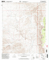
2001 Map of Pinon Ranch
USGS Topo · Published 2003About this map
Piñon Ranch and a network of family-held ranchlands define this high-altitude landscape along the border of Chaves and Otero counties. The map captures an arid environment managed for livestock, where water infrastructure like Woods Tank, Hooten Tank, and Crim Tank are critical markers of survival and territory. These man-made tanks, along with Piñon Well and South Well, serve as the primary hubs for activity in a region otherwise dominated by dramatic geographic features like Lewis Canyon and the Collins Hills.
Find a feature on this map
31 named features on this map. Tap any name to fly to it.
Don’t see what you’re looking for? This feature index may not catch every label — zoom into the map to look around manually.
Map Details
Editions of this 2001 Pinon Ranch Map
This is the sole edition of this map. No revisions or reprints were ever made.
Other maps of this area

1954 · Carlsbad
USGS Topo · 1:250,000

1958 · Carlsbad
USGS Topo · 1:250,000

1963 · Cornucopia Canyon
USGS Topo · 1:24,000

1963 · Tanner Ranch
USGS Topo · 1:24,000

1963 · Panama Ranch
USGS Topo · 1:24,000

1965 · Lewis Peak NE
USGS Topo · 1:24,000

1965 · Chimney Lake
USGS Topo · 1:24,000

1965 · Lewis Peak
USGS Topo · 1:24,000

1965 · Bullis Spring Ranch
USGS Topo · 1:24,000

1965 · Pinon Ranch
USGS Topo · 1:24,000