
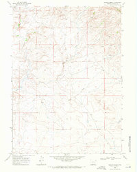
2015 Map of Pinto Creek
USGS Topo · Published 2015About this map
The N Laramie River winds through this high-altitude landscape in Albany County, defining a region where water management is central to the terrain's character. In this 2015 survey, the proliferation of drainage features and catchments like Twentymile Draw and Twentytwo Mile Draw indicates a landscape engineered for ranching and resource management. The map details several significant water storage sites, including Pinto Reservoir, Twentymile Reservoir, and the specifically numbered Sturgeon Reservoir Number 3. Isolated water sources such as Three Tree Spring, Pinto Spring, and Solomon Springs serve as vital landmarks across the open range. Transportation is defined by a sparse network of throughways including Garrett Rd and Sugarloaf Mountain Rd, which provide access to these remote ranching lands.
Find a feature on this map
27 named features on this map. Tap any name to fly to it.
Don’t see what you’re looking for? This feature index may not catch every label — zoom into the map to look around manually.
Map Details
Editions of this 2015 Pinto Creek Map
This is the sole edition of this map. No revisions or reprints were ever made.
Other maps of this area

1954 · Torrington
USGS Topo · 1:250,000

1954 · Cheyenne
USGS Topo · 1:250,000

1955 · Dodge Ranch
USGS Topo · 1:24,000

1955 · Sevenmile Spring
USGS Topo · 1:24,000

1955 · Ayres Spring
USGS Topo · 1:24,000

1958 · Cheyenne
USGS Topo · 1:250,000

1958 · Torrington
USGS Topo · 1:250,000

1968 · Cow Creek Mountain
USGS Topo · 1:24,000

1968 · Cottonwood Creek
USGS Topo · 1:24,000
1968 · Rogers Creek
USGS Topo · 1:24,000