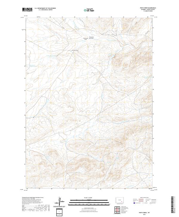
2021 Map of Pinto Creek
USGS Topo · Published 2021About this map
The N Laramie River meanders across the northern reaches of this Albany County landscape, defining a network of drainage systems and draws that characterize this high plains environment. Water management is a central theme of the terrain, with features like Pinto Reservoir, Twentymile Reservoir, and Sturgeon Reservoir Number 3 marking attempts to harness the seasonal flow of the Pinto Cr and Little Pinto Cr systems. Historically significant water sources for early ranching and travel are clearly documented, including Pinto Spring, Three Tree Spring, and Solomon Springs. The map illustrates a sparse but deliberate infrastructure, where Co RD 74 and Bear Creek Rd provide the primary transit through a territory still organized by the Public Land Survey System, including portions of T24N R74W and T25N R73W. This modern survey preserves the locations of numerous draws like Elk Horn Draw and Twentymile Draw, which have long served as natural landmarks in this expansive ranching country.
Find a feature on this map
26 named features on this map. Tap any name to fly to it.
Don’t see what you’re looking for? This feature index may not catch every label — zoom into the map to look around manually.
Map Details
Editions of this 2021 Pinto Creek Map
This is the sole edition of this map. No revisions or reprints were ever made.
Other maps of this area

1954 · Torrington
USGS Topo · 1:250,000

1954 · Cheyenne
USGS Topo · 1:250,000

1955 · Dodge Ranch
USGS Topo · 1:24,000

1955 · Sevenmile Spring
USGS Topo · 1:24,000

1955 · Ayres Spring
USGS Topo · 1:24,000

1958 · Cheyenne
USGS Topo · 1:250,000

1958 · Torrington
USGS Topo · 1:250,000

1968 · Cow Creek Mountain
USGS Topo · 1:24,000

1968 · Cottonwood Creek
USGS Topo · 1:24,000
1968 · Rogers Creek
USGS Topo · 1:24,000