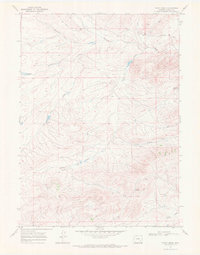
1968 Map of Pinto Creek
USGS Topo · Published 1972About this map
North Laramie Creek and its complex network of tributaries define this high-plains landscape in Albany County, Wyoming. The drainage patterns of Pinto Creek and the South Fork Pinto Creek reveal a land shaped by scarce water, where isolated water sources were critical for ranching and settlement. Key landmarks such as Elk Horn Spring, Three Tree Spring, and Salomon Springs provide essential grounding for local history and land-use studies. The infrastructure of the late 1960s is represented by Garrett Road and several man-made water catchments, including Twentymile Reservoir and Sturgeon Res No 3. These features indicate a coordinated effort to manage the watershed across the undulating terrain of Twentymile Draw and Coon Creek.
Find a feature on this map
16 named features on this map. Tap any name to fly to it.
Don’t see what you’re looking for? This feature index may not catch every label — zoom into the map to look around manually.
Map Details
Editions of this 1968 Pinto Creek Map
This is the sole edition of this map. No revisions or reprints were ever made.
Other maps of this area

1954 · Torrington
USGS Topo · 1:250,000

1954 · Cheyenne
USGS Topo · 1:250,000

1955 · Dodge Ranch
USGS Topo · 1:24,000

1955 · Sevenmile Spring
USGS Topo · 1:24,000

1955 · Ayres Spring
USGS Topo · 1:24,000

1958 · Cheyenne
USGS Topo · 1:250,000

1958 · Torrington
USGS Topo · 1:250,000

1968 · Cow Creek Mountain
USGS Topo · 1:24,000

1968 · Cottonwood Creek
USGS Topo · 1:24,000
1968 · Rogers Creek
USGS Topo · 1:24,000