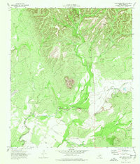
1974 Map of Pinto Mountain
USGS Topo · Published 1976About this map
Alamo Village stands out as a focal point in this Kinney County landscape, situated near the intersection of several local drainages. The area is dominated by the prominent rise of Pinto Mountain, which anchors the central terrain above the winding course of Pinto Creek. The presence of several Landing Strip locations suggests the logistical importance of aviation for ranching or private travel in this part of South Texas during the mid-1970s.
Find a feature on this map
8 named features on this map. Tap any name to fly to it.
Don’t see what you’re looking for? This feature index may not catch every label — zoom into the map to look around manually.
Map Details
Editions of this 1974 Pinto Mountain Map
This is the sole edition of this map. No revisions or reprints were ever made.
Other maps of this area

1893 · Nueces
USGS Topo · 1:125,000

1896 · Nueces
USGS Topo · 1:125,000

1896 · Brackett
USGS Topo · 1:125,000

1897 · Brackett
USGS Topo · 1:125,000

1941 · Standart
USGS Topo · 1:62,500

1943 · Standart
USGS Topo · 1:62,500

1944 · Flat Rock
USGS Topo · 1:62,500

1944 · Brackettville
USGS Topo · 1:62,500

1944 · Indian Mountain
USGS Topo · 1:62,500

1958 · Del Rio
USGS Topo · 1:250,000