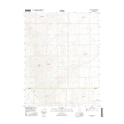
2017 Map of Pinto Spring
USGS Topo · Published 2017About this map
The Indian Peak Range dominates this section of the Iron and Beaver County border, where a network of seasonal water sources sustained early high-country activity. The map reveals a cluster of named springs and drainage basins that defined the local geography before modern water management, including Merrills Camp Spring and the curiously named Big Basket Spring and Little Basket Springs. These features, along with several others like Pinto Spring and Arrowhead Spring, indicate a landscape where every reliable water source was historically significant for land use and navigation.
Find a feature on this map
25 named features on this map. Tap any name to fly to it.
Don’t see what you’re looking for? This feature index may not catch every label — zoom into the map to look around manually.
Map Details
Editions of this 2017 Pinto Spring Map
This is the sole edition of this map. No revisions or reprints were ever made.
Other maps of this area

1953 · Richfield
USGS Topo · 1:250,000

1958 · Richfield
USGS Topo · 1:250,000

1971 · Observation Knoll
USGS Topo · 1:24,000

1971 · Pine Grove Reservoir
USGS Topo · 1:24,000

1971 · Pinto Spring
USGS Topo · 1:24,000

1971 · Steamboat Mtn SW
USGS Topo · 1:24,000

1971 · Bible Spring
USGS Topo · 1:24,000

1971 · Atchison Creek
USGS Topo · 1:24,000

1971 · Steamboat Mtn
USGS Topo · 1:24,000
1972 · Buckhorn Spring
USGS Topo · 1:24,000