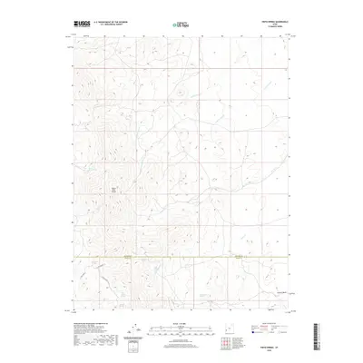
2020 Map of Pinto Spring
USGS Topo · Published 2020About this map
The Indian Peak Range dominates this portion of the high desert along the border of Beaver and Iron Counties. Water is the defining resource of this landscape, evidenced by the high concentration of named springs that supported early ranching and livestock operations. The sheet traces the delicate drainage patterns of Cottonwood Cr, Commissary Cr, and Sheep Cr as they move through the mountainous terrain.
Find a feature on this map
16 named features on this map. Tap any name to fly to it.
Don’t see what you’re looking for? This feature index may not catch every label — zoom into the map to look around manually.
Map Details
Editions of this 2020 Pinto Spring Map
This is the sole edition of this map. No revisions or reprints were ever made.
Other maps of this area

1953 · Richfield
USGS Topo · 1:250,000

1958 · Richfield
USGS Topo · 1:250,000

1971 · Observation Knoll
USGS Topo · 1:24,000

1971 · Pine Grove Reservoir
USGS Topo · 1:24,000

1971 · Pinto Spring
USGS Topo · 1:24,000

1971 · Steamboat Mtn SW
USGS Topo · 1:24,000

1971 · Bible Spring
USGS Topo · 1:24,000

1971 · Atchison Creek
USGS Topo · 1:24,000

1971 · Steamboat Mtn
USGS Topo · 1:24,000
1972 · Buckhorn Spring
USGS Topo · 1:24,000