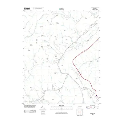
2010 Map of Pioneer
USGS Topo · Published 2010About this map
Mooney Mine and the Phillips Red Ash Mine reflect the legacy of the regional coal industry in this high-country landscape of the southern Appalachians. The terrain is defined by prominent peaks like Zeb Mountain and Braden Mountain, separated by deep gaps and hollows such as Botts Gap and Stillhouse Hollow. This complex topography dictated the flow of local commerce and travel, with roads like Lick Fork Rd and Old State Hwy 63 following the natural contours of the drainages.
Find a feature on this map
111 named features on this map. Tap any name to fly to it.
Don’t see what you’re looking for? This feature index may not catch every label — zoom into the map to look around manually.
Map Details
Editions of this 2010 Pioneer Map
This is the sole edition of this map. No revisions or reprints were ever made.
Other maps of this area

1890 · Williamsburg
USGS Topo · 1:125,000

1893 · Briceville
USGS Topo · 1:125,000

1894 · Williamsburg
USGS Topo · 1:125,000

1895 · Briceville
USGS Topo · 1:125,000

1896 · Briceville
USGS Topo · 1:125,000

1936 · Ivydell
USGS Topo · 1:24,000

1936 · Block
USGS Topo · 1:24,000

1936 · Jacksboro
USGS Topo · 1:24,000

1936 · Pioneer
USGS Topo · 1:24,000

1936 · La Follette
USGS Topo · 1:48,000