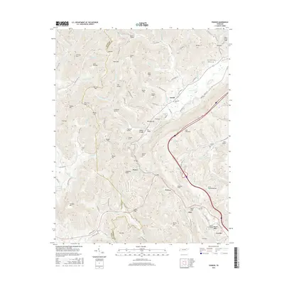
2016 Map of Pioneer
USGS Topo · Published 2016About this map
Pioneer and the surrounding mountain settlements of Titus and Stanfill anchor this survey of the northern Tennessee Cumberland Plateau. The landscape is defined by the steep relief of Pine Mountain and the divide between Scott and Campbell counties, where the headwaters of Lick Fork and Stinking Creek cut through the terrain. The presence of numerous family-named landmarks like Chimney Mtn, Sexton Mtn, and Zeb Mtn reflects the deeply rooted rural communities of the era. The mapping details a complex transportation network of named mountain roads, such as Old State Hwy 63 and Stinking Creek Rd, which connect isolated hollows like Stillhouse Hollow and Long Hollow. Notable for genealogists, the map preserves the exact locations of several small burial grounds, including Valley View Cem, Sharp Cem, and Meredith Cem, often situated near the gaps and ridges that shaped local travel and settlement patterns.
Find a feature on this map
112 named features on this map. Tap any name to fly to it.
Don’t see what you’re looking for? This feature index may not catch every label — zoom into the map to look around manually.
Map Details
Editions of this 2016 Pioneer Map
This is the sole edition of this map. No revisions or reprints were ever made.
Other maps of this area

1890 · Williamsburg
USGS Topo · 1:125,000

1893 · Briceville
USGS Topo · 1:125,000

1894 · Williamsburg
USGS Topo · 1:125,000

1895 · Briceville
USGS Topo · 1:125,000

1896 · Briceville
USGS Topo · 1:125,000

1936 · Ivydell
USGS Topo · 1:24,000

1936 · Block
USGS Topo · 1:24,000

1936 · Jacksboro
USGS Topo · 1:24,000

1936 · Pioneer
USGS Topo · 1:24,000

1936 · La Follette
USGS Topo · 1:48,000