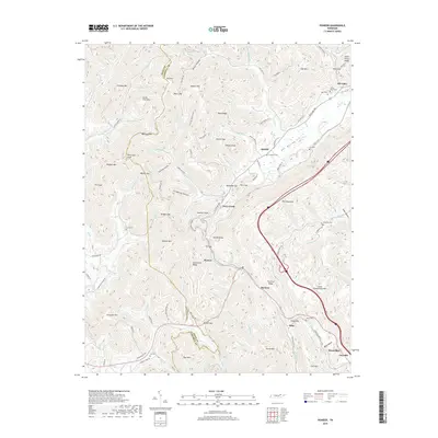
2019 Map of Pioneer
USGS Topo · Published 2019About this map
Pine Mountain dominates the eastern expanse of this survey, where the rugged topography of the Cumberland Plateau meets the small communities of northern Campbell County. The high ridgelines are carved by numerous waterways like Elk Fork Cr and Stinking Cr, defining a landscape where travel remains focused along historic routes such as Old Hwy 63 and Newcomb Pike. Small settlements like Pioneer and Elk Valley are situated in the lower elevations, surrounded by family landmarks such as Lay Cem and Meredith Cem. The map illustrates the persistent influence of the Scott and Campbell County line, which traverses several high points including Ned Mtn. This document captures the modern state of these rural highlands, showcasing how contemporary infrastructure and longstanding residential patterns coexist among prominent geological features like Hackle Knob and Gunsight Mtn.
Find a feature on this map
117 named features on this map. Tap any name to fly to it.
Don’t see what you’re looking for? This feature index may not catch every label — zoom into the map to look around manually.
Map Details
Editions of this 2019 Pioneer Map
This is the sole edition of this map. No revisions or reprints were ever made.
Other maps of this area

1890 · Williamsburg
USGS Topo · 1:125,000

1893 · Briceville
USGS Topo · 1:125,000

1894 · Williamsburg
USGS Topo · 1:125,000

1895 · Briceville
USGS Topo · 1:125,000

1896 · Briceville
USGS Topo · 1:125,000

1936 · Ivydell
USGS Topo · 1:24,000

1936 · Block
USGS Topo · 1:24,000

1936 · Jacksboro
USGS Topo · 1:24,000

1936 · Pioneer
USGS Topo · 1:24,000

1936 · La Follette
USGS Topo · 1:48,000