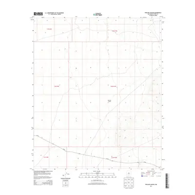
2013 Map of Pipeline Canyon
USGS Topo · Published 2013About this map
Pipeline Canyon serves as the namesake geographic anchor for this high-desert landscape in Otero County. The terrain is defined by a sparse network of natural drainage and the singular presence of NM-506, which traverses the southern portion of the quadrangle. This 2013 survey illustrates the expansive, undeveloped character of the region, where land management is organized by a precise grid of township and range boundaries including t20s r10e and t19s r9e. The map reflects a modern record of this arid territory, documenting the relationship between a significant regional thoroughfare and the underlying topography of the Tularosa Basin area.
Find a feature on this map
8 named features on this map. Tap any name to fly to it.
Don’t see what you’re looking for? This feature index may not catch every label — zoom into the map to look around manually.
Map Details
Editions of this 2013 Pipeline Canyon Map
This is the sole edition of this map. No revisions or reprints were ever made.
Other maps of this area

1916 · Point Of Sands
USGS Topo · 1:125,000

1940 · Orogrande
USGS Topo · 1:62,500

1943 · Pendejo Wash
USGS Topo · 1:62,500

1943 · Orogrande
USGS Topo · 1:62,500

1947 · Orogrande North
USGS Topo · 1:24,000

1948 · Tres Hermanos
USGS Topo · 1:62,500

1950 · Escondido Canyon
USGS Topo · 1:62,500

1954 · Carlsbad
USGS Topo · 1:250,000
1955 · Orogrande North
USGS Topo · 1:24,000

1955 · Las Cruces
USGS Topo · 1:250,000