
2017 Map of Pipeline Canyon
USGS Topo · Published 2017About this map
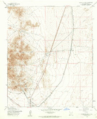
Pipeline Canyon serves as the central topographic landmark within this high-desert Otero County landscape. The area is defined by the Public Land Survey System (PLSS) grid, spanning multiple townships including t20s r9e, t20s r10e, and t21s r10e. The map illustrates the natural drainage patterns and elevation contours typical of the Sacramento Mountains foothills, showing how the local topography funnels toward the primary canyon feature. As a recent 2017 survey, it documents the modern road network and land divisions while preserving the formal township and range boundaries established during the original western settlement surveys.
Find a feature on this map
7 named features on this map. Tap any name to fly to it.
Don’t see what you’re looking for? This feature index may not catch every label — zoom into the map to look around manually.
Map Details
Editions of this 2017 Pipeline Canyon Map
This is the sole edition of this map. No revisions or reprints were ever made.
Other maps of this area

1916 · Point Of Sands
USGS Topo · 1:125,000

1940 · Orogrande
USGS Topo · 1:62,500

1943 · Pendejo Wash
USGS Topo · 1:62,500

1943 · Orogrande
USGS Topo · 1:62,500

1947 · Orogrande North
USGS Topo · 1:24,000

1948 · Tres Hermanos
USGS Topo · 1:62,500

1950 · Escondido Canyon
USGS Topo · 1:62,500

1954 · Carlsbad
USGS Topo · 1:250,000
1955 · Orogrande North
USGS Topo · 1:24,000

1955 · Las Cruces
USGS Topo · 1:250,000