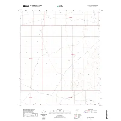
2020 Map of Pipeline Canyon
USGS Topo · Published 2020About this map
Pipeline Canyon serves as the central topographic feature of this high-desert landscape in Otero County. Situated within the expanse of the Lincoln National Forest region, the area is defined by sharp elevation changes and drainage systems that feed into the canyon. The southern portion of the quadrangle is traversed by Owen Prather Hwy, providing the primary transit corridor through these arid lands. This modern 2020 survey illustrates the remote character of the basin-and-range terrain, focusing on the public land survey system grid across township lines like t20s r10e. For those studying the geography of south-central New Mexico, the map details the precise contours of the local watershed and the limited road network that dictates access to this isolated area.
Find a feature on this map
8 named features on this map. Tap any name to fly to it.
Don’t see what you’re looking for? This feature index may not catch every label — zoom into the map to look around manually.
Map Details
Editions of this 2020 Pipeline Canyon Map
This is the sole edition of this map. No revisions or reprints were ever made.
Other maps of this area

1916 · Point Of Sands
USGS Topo · 1:125,000

1940 · Orogrande
USGS Topo · 1:62,500

1943 · Pendejo Wash
USGS Topo · 1:62,500

1943 · Orogrande
USGS Topo · 1:62,500

1947 · Orogrande North
USGS Topo · 1:24,000

1948 · Tres Hermanos
USGS Topo · 1:62,500

1950 · Escondido Canyon
USGS Topo · 1:62,500

1954 · Carlsbad
USGS Topo · 1:250,000
1955 · Orogrande North
USGS Topo · 1:24,000

1955 · Las Cruces
USGS Topo · 1:250,000