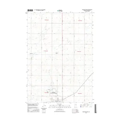
2016 Map of Pipestone North
USGS Topo · Published 2016About this map
Pipestone National Monument anchors the southern portion of this landscape, preserving the culturally significant red pipestone quarries used by Plains Indians. The terrain is defined by the Coteau des Prairies, a high glacial plateau that rises above the surrounding plains. The city of Pipestone sits just south of the monument, while the smaller settlement of Cazenovia is located to the northwest. Water drainage is dominated by the seasonal paths of N Br Pipestone Cr and the S Br Pipestone Cr, which converge near the historic quarries. For genealogists, several local burial sites are recorded, including Troy Cem, Woodlawn Cem, and Saint Leo Cem. The map illustrates a highly organized section-line road grid, showing how the agricultural layout of Pipestone County was firmly established by the early 21st century.
Find a feature on this map
39 named features on this map. Tap any name to fly to it.
Don’t see what you’re looking for? This feature index may not catch every label — zoom into the map to look around manually.
Map Details
Editions of this 2016 Pipestone North Map
This is the sole edition of this map. No revisions or reprints were ever made.
Other maps of this area

1953 · Watertown
USGS Topo · 1:250,000

1955 · Sioux Falls
USGS Topo · 1:250,000

1958 · Sioux Falls
USGS Topo · 1:250,000

1958 · Watertown
USGS Topo · 1:250,000

1967 · Pipestone North
USGS Topo · 1:24,000

1967 · Edgerton North
USGS Topo · 1:24,000

1967 · Ruthton NW
USGS Topo · 1:24,000

1967 · Elkton SW
USGS Topo · 1:24,000

1967 · Verdi
USGS Topo · 1:24,000

1967 · Pipestone South
USGS Topo · 1:24,000