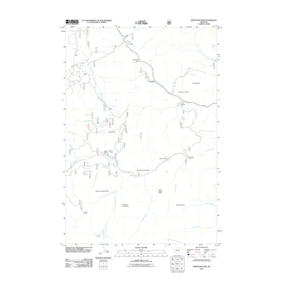
2011 Map of Pipestone Pass
USGS Topo · Published 2011About this map
Pipestone Pass serves as a critical geographic divide in this high-altitude landscape near Donald, Montana. The terrain is defined by a complex network of ridges and drainages, including Mammoth Creek Ridge, Pigeon Creek Ridge, and the winding Blacktail Creek. This 2011 survey documents the area's ongoing mix of natural resources and public recreation, where the SE NW Section 18 Mine sits just miles from Pigeon Creek Campground and the waters of Emerald Lake.
Find a feature on this map
35 named features on this map. Tap any name to fly to it.
Don’t see what you’re looking for? This feature index may not catch every label — zoom into the map to look around manually.
Map Details
Editions of this 2011 Pipestone Pass Map
This is the sole edition of this map. No revisions or reprints were ever made.
Other maps of this area

1893 · Dillon
USGS Topo · 1:250,000

1955 · Dillon
USGS Topo · 1:250,000

1957 · Dillon
USGS Topo · 1:250,000

1958 · Dillon
USGS Topo · 1:250,000

1960 · Twin Bridges
USGS Topo · 1:62,500

1961 · Wickiup Creek
USGS Topo · 1:24,000

1961 · Butte South
USGS Topo · 1:62,500

1962 · Dillon
USGS Topo · 1:250,000

1963 · Pipestone Pass
USGS Topo · 1:24,000
1963 · Homestake
USGS Topo · 1:24,000