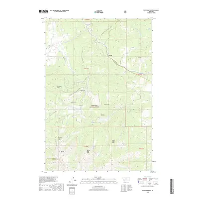
2020 Map of Pipestone Pass
USGS Topo · Published 2020About this map
Pipestone Pass serves as a critical high-altitude corridor where the Continental Divide National Scenic Trail winds through the high country of the Deerlodge National Forest. This 2020 survey documents the complex drainage systems of the Highland Mountains, where headwaters like Roaring Brook and Mammoth Cr flow toward the southern boundaries of Silver Bow and Madison counties. The topographic detail highlights the transition from the settlement at Donald toward the prominent peaks of Toll Mtn and Red Mtn.
Find a feature on this map
47 named features on this map. Tap any name to fly to it.
Don’t see what you’re looking for? This feature index may not catch every label — zoom into the map to look around manually.
Map Details
Editions of this 2020 Pipestone Pass Map
This is the sole edition of this map. No revisions or reprints were ever made.
Other maps of this area

1893 · Dillon
USGS Topo · 1:250,000

1955 · Dillon
USGS Topo · 1:250,000

1957 · Dillon
USGS Topo · 1:250,000

1958 · Dillon
USGS Topo · 1:250,000

1960 · Twin Bridges
USGS Topo · 1:62,500

1961 · Wickiup Creek
USGS Topo · 1:24,000

1961 · Butte South
USGS Topo · 1:62,500

1962 · Dillon
USGS Topo · 1:250,000

1963 · Pipestone Pass
USGS Topo · 1:24,000
1963 · Homestake
USGS Topo · 1:24,000