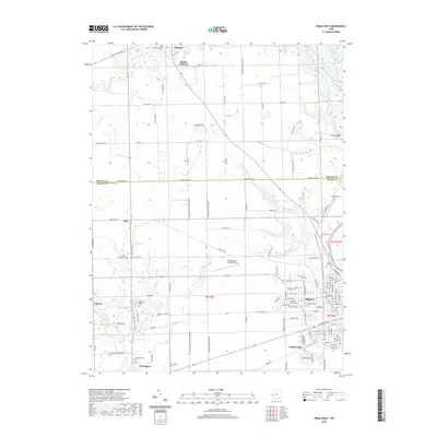
2019 Map of Piqua West
USGS Topo · Published 2019About this map
The Stillwater River and Loramie Creek converge in this western section of Miami County, defining a landscape of agricultural drainage and historical settlements. To the east, the city of Piqua shows a dense street grid including Washington Ave and Covington Ave, while the village of Covington sits at the southwestern edge. The map highlights a significant genealogical record through numerous burial sites such as Miami Memorial Cem, Houston Cem, and Forest Hill Cem. Transportation patterns are characterized by a transition from the rural grid of roads like Russia Houston Rd to the aviation infrastructure at Piqua Airport-Hartzell Field and the recreational corridor of the Dayton-National Scenic Trail. Water management is evident through an extensive system of named ditches, including Sigmon Ditch and Apple Ditch, which support the region's productive farmland.
Find a feature on this map
135 named features on this map. Tap any name to fly to it.
Don’t see what you’re looking for? This feature index may not catch every label — zoom into the map to look around manually.
Map Details
Editions of this 2019 Piqua West Map
This is the sole edition of this map. No revisions or reprints were ever made.
Other maps of this area

1909 · Loramie
USGS Topo · 1:62,500

1911 · Loramie
USGS Topo · 1:62,500

1911 · Covington
USGS Topo · 1:62,500

1913 · Sidney
USGS Topo · 1:62,500

1914 · Troy
USGS Topo · 1:62,500

1944 · Covington
USGS Topo · 1:62,500

1944 · Sidney
USGS Topo · 1:62,500

1944 · Loramie
USGS Topo · 1:62,500

1944 · Troy
USGS Topo · 1:62,500

1953 · Muncie
USGS Topo · 1:250,000