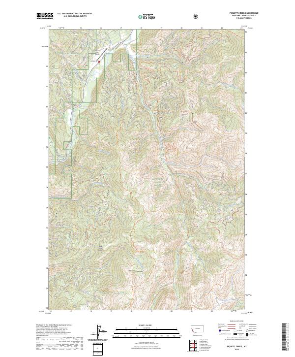
2024 Map of Piquett Creek
USGS Topo · Published 2024About this map
The Bitterroot National Forest dominates this section of the Bitterroot Mountains, where steep drainage systems feed the West Fork Bitterroot River. A complex network of Forest Service infrastructure, including the West Fork Lodge Airport and numerous access routes like Kucera Rd and W Fork Rd, highlights the area's role in forest management and back-country recreation. Historical pack trails and modern routes intersect throughout the terrain, with the Piquett Divide Trl and Upper East Side Piquett Trl tracing the high ridges between Piquett Creek and its tributaries.
Find a feature on this map
49 named features on this map. Tap any name to fly to it.
Don’t see what you’re looking for? This feature index may not catch every label — zoom into the map to look around manually.
Map Details
Editions of this 2024 Piquett Creek Map
This is the sole edition of this map. No revisions or reprints were ever made.
Other maps of this area

1956 · Elk City
USGS Topo · 1:250,000

1960 · Elk City
USGS Topo · 1:250,000

1960 · Painted Rocks Lake
USGS Topo · 1:62,500

1960 · Piquett Mountain
USGS Topo · 1:62,500

1964 · Burnt Ridge
USGS Topo · 1:24,000

1964 · Boulder Peak
USGS Topo · 1:24,000
1964 · Trapper Peak
USGS Topo · 1:24,000
1964 · Robbins Gulch
USGS Topo · 1:24,000

1964 · Piquett Creek
USGS Topo · 1:24,000

1965 · Medicine Hot Springs
USGS Topo · 1:24,000