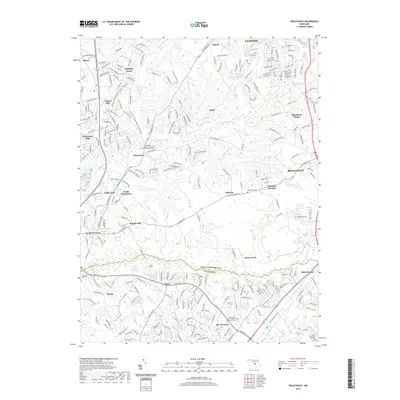
2019 Map of Piscataway
USGS Topo · Published 2019About this map
The boundary between Prince George's and Charles counties divides this landscape, where suburban expansion meets the wetland systems of the Coastal Plain. In the northern reaches, Clinton and Tippett show dense residential development near Cosca Park and the Clinton Regional Park Lake. Central to the map is the historic Piscataway area, where Saint Marys Catholic Church of Piscataway and the nearby Piscataway Cem serve as long-standing community landmarks. The Potomac Heritage National Scenic Trail winds through the western hills, following the topography above Piscataway Cr. To the south, the terrain levels out near the Mattawoman Cr drainage, where newer developments like Bel Air Acres and Berry sit alongside the Zion Wesley United Methodist Church-Cem, illustrating the continued layering of modern life over traditional rural foundations.
Find a feature on this map
39 named features on this map. Tap any name to fly to it.
Don’t see what you’re looking for? This feature index may not catch every label — zoom into the map to look around manually.
Map Details
Editions of this 2019 Piscataway Map
This is the sole edition of this map. No revisions or reprints were ever made.
Other maps of this area

1890 · Mt. Vernon
USGS Topo · 1:125,000

1891 · Mt. Vernon
USGS Topo · 1:125,000

1892 · Brandywine
USGS Topo · 1:62,500

1894 · Mt. Vernon
USGS Topo · 1:125,000

1895 · Brandywine
USGS Topo · 1:62,500

1897 · Mt. Vernon
USGS Topo · 1:125,000

1899 · Patuxent
USGS Topo · 1:125,000

1900 · Washington
USGS Topo · 1:62,500

1906 · Patuxent
USGS Topo · 1:125,000

1911 · Brandywine
USGS Topo · 1:62,500