
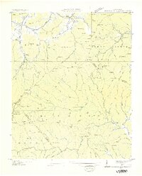
1935 Map of Pisgah Forest
USGS Topo · Published 1935About this map
The Pink Beds anchor the northern reaches of this 1935 survey, a unique high-elevation valley that has long been a focal point of North Carolina forestry. The landscape is defined by the deep drainage of the South Fork Mills River and the Davidson River, where the U.S. Forest Service Administrative Site and CCC Camp No P 66 signal the era of active federal conservation and mountain management. In the lower elevations to the south and east, the Southern Railway corridor connects small settlements like Blantyre and Penrose, where local life is marked by the Penrose Sch, Enon Ch, and Turkey Creek Ch. The presence of the Davidson River Cem and Osborn Cem offers specific touchpoints for family historians. This record preserves the terrain just as the Pisgah National Forest was being established as a cornerstone of the regional economy and environmental identity.
Find a feature on this map
144 named features on this map. Tap any name to fly to it.
Don’t see what you’re looking for? This feature index may not catch every label — zoom into the map to look around manually.
Map Details
Editions of this 1935 Pisgah Forest Map
This is the sole edition of this map. No revisions or reprints were ever made.
Other maps of this area

1905 · Pisgah
USGS Topo · 1:125,000

1906 · Pisgah
USGS Topo · 1:125,000

1935 · Cruso
USGS Topo · 1:24,000

1935 · Brevard
USGS Topo · 1:24,000

1935 · Standingstone Mtn.
USGS Topo · 1:24,000

1935 · Horse Shoe
USGS Topo · 1:24,000

1935 · Rosman
USGS Topo · 1:24,000

1935 · Shining Rock
USGS Topo · 1:24,000

1936 · Skyland
USGS Topo · 1:24,000
1936 · Dunsmore Mountain
USGS Topo · 1:24,000