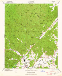
1945 Map of Pisgah Forest
USGS Topo · Published 1964About this map
The Southern Railway corridor anchors the southern valley of this 1945 survey, connecting industrial sites like Ecusta and the settlement of Pisgah Forest to the broader regional economy. This low-lying agricultural and industrial land in Boyd Township contrasts sharply with the dense, ridge-and-valley terrain of the Pisgah National Forest to the north. The map documents a landscape of established community life, featuring numerous rural centers of worship and education such as English Chapel, Enon Ch, and the Glade Creek Sch.
Find a feature on this map
129 named features on this map. Tap any name to fly to it.
Don’t see what you’re looking for? This feature index may not catch every label — zoom into the map to look around manually.
Map Details
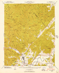
Editions of this 1945 Pisgah Forest Map
2 editions found
Other maps of this area

1905 · Pisgah
USGS Topo · 1:125,000

1906 · Pisgah
USGS Topo · 1:125,000

1935 · Cruso
USGS Topo · 1:24,000

1935 · Brevard
USGS Topo · 1:24,000

1935 · Standingstone Mtn.
USGS Topo · 1:24,000

1935 · Horse Shoe
USGS Topo · 1:24,000

1935 · Rosman
USGS Topo · 1:24,000

1935 · Shining Rock
USGS Topo · 1:24,000

1935 · Pisgah Forest
USGS Topo · 1:24,000

1936 · Skyland
USGS Topo · 1:24,000