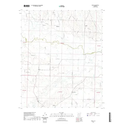
2020 Map of Pisgah
USGS Topo · Published 2020About this map
The Little Missouri River meanders across this Southwest Arkansas landscape, forming the natural boundary between Hempstead Co and Pike Co. The terrain is defined by a dense network of tributaries including Ozan Cr, Hickory Cr, and Number One Bayou, which feed into the primary river valley. Small rural settlements like Billstown, Pisgah, and Blevins are connected by a web of county roads and state highways, reflecting the agricultural and residential patterns of the region.
Find a feature on this map
77 named features on this map. Tap any name to fly to it.
Don’t see what you’re looking for? This feature index may not catch every label — zoom into the map to look around manually.
Map Details
Editions of this 2020 Pisgah Map
This is the sole edition of this map. No revisions or reprints were ever made.
Other maps of this area

1901 · Gurdon
USGS Topo · 1:125,000

1906 · Caddo Gap
USGS Topo · 1:125,000

1943 · Antoine
USGS Topo · 1:62,500

1951 · Blevins
USGS Topo · 1:24,000

1951 · Washington
USGS Topo · 1:24,000

1951 · Pisgah
USGS Topo · 1:24,000

1951 · McCaskill
USGS Topo · 1:24,000

1953 · El Dorado
USGS Topo · 1:250,000

1955 · Little Rock
USGS Topo · 1:250,000

1956 · Little Rock
USGS Topo · 1:250,000