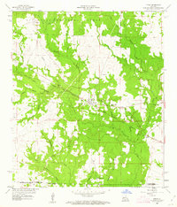
1959 Map of Pitkin
USGS Topo · Published 1962About this map
The settlement of Pitkin serves as the central hub of this late-1950s survey, where the Gulf Colorado And Santa Fe railroad cuts a diagonal path through the timbered landscape. Much of the northern terrain is occupied by the Kisatchie National Forest, a region defined by the intricate drainage networks of Sixmile Creek and Big Brushy Creek. The map documents a rural society structured around small community centers and family landmarks, such as Fullerton in the northwest and Dido to the southeast.
Find a feature on this map
31 named features on this map. Tap any name to fly to it.
Don’t see what you’re looking for? This feature index may not catch every label — zoom into the map to look around manually.
Map Details
Editions of this 1959 Pitkin Map
4 editions found
Other maps of this area

1941 · Slagle
USGS Topo · 1:62,500

1943 · Leander
USGS Topo · 1:62,500

1944 · Slagle
USGS Topo · 1:62,500

1947 · Steep Gully
USGS Topo · 1:31,680

1947 · Elizabeth
USGS Topo · 1:31,680

1947 · Grant
USGS Topo · 1:31,680

1947 · Sugartown
USGS Topo · 1:31,680

1947 · Sugrue
USGS Topo · 1:31,680

1947 · Pitkin
USGS Topo · 1:31,680

1948 · Grant
USGS Topo · 1:24,000