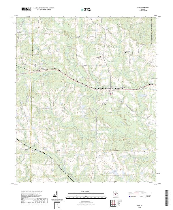
2024 Map of Pitts
USGS Topo · Published 2024About this map
The Alapaha River headwaters wind through this rural landscape on the border of Crisp and Wilcox counties. The agricultural character of the region is defined by several small settlements including Pitts and Seville, which sit along a prominent east-west railroad corridor. Local genealogy is well-documented through a network of rural burial grounds, ranging from the central Snow Hill Cem to the outlying Fitzgerald Cem. The terrain is scattered with numerous small water bodies, such as McBryant Lake and South Jones Lake, which interrupt the vast network of county roads like Co Rd 254 and Rochelle Rd. This survey provides a clear view of the intersection between traditional southern land use and the natural drainage patterns of Double Run Creek.
Find a feature on this map
92 named features on this map. Tap any name to fly to it.
Don’t see what you’re looking for? This feature index may not catch every label — zoom into the map to look around manually.
Map Details
Editions of this 2024 Pitts Map
This is the sole edition of this map. No revisions or reprints were ever made.
Other maps of this area

1953 · Waycross
USGS Topo · 1:250,000

1957 · Macon
USGS Topo · 1:250,000

1958 · Macon
USGS Topo · 1:250,000

1958 · Waycross
USGS Topo · 1:250,000

1964 · Macon
USGS Topo · 1:250,000

1971 · Pineview West
USGS Topo · 1:24,000

1971 · Pineview SW
USGS Topo · 1:24,000

1972 · Pineview East
USGS Topo · 1:24,000

1974 · Rebecca
USGS Topo · 1:24,000
1974 · Pitts
USGS Topo · 1:24,000