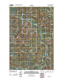
2011 Map of Pittsburg
USGS Topo · Published 2011About this map
The Nehalem River defines the geography of this portion of Columbia County, winding through the Nehalem Valley and creating a corridor for early settlement and transport. Small communities like Natal and Pittsburg serve as the primary human hubs in an area otherwise dominated by the timber-rich ridges of the Oregon Coast Range. The map reveals an extensive network of main lines and logging roads, such as Crooked Creek Mnln and Kauppi Mnln, which trace the drainage basins of Rock Creek and Crooked Creek.
Find a feature on this map
43 named features on this map. Tap any name to fly to it.
Don’t see what you’re looking for? This feature index may not catch every label — zoom into the map to look around manually.
Map Details
Editions of this 2011 Pittsburg Map
This is the sole edition of this map. No revisions or reprints were ever made.
Other maps of this area

1919 · Mayger
USGS Topo · 1:62,500

1940 · Vernonia
USGS Topo · 1:62,500

1941 · Keasey
USGS Topo · 1:62,500

1941 · Clatskanie
USGS Topo · 1:62,500

1941 · Cathlamet
USGS Topo · 1:62,500

1943 · Vernonia
USGS Topo · 1:62,500

1943 · Keasey
USGS Topo · 1:62,500

1948 · Vancouver
USGS Topo · 1:250,000

1950 · Vancouver
USGS Topo · 1:250,000

1950 · Vancouver
USGS Topo · 1:250,000